The History of El Cocuy: Pueblo, U’Wa Culture, and the Páramo
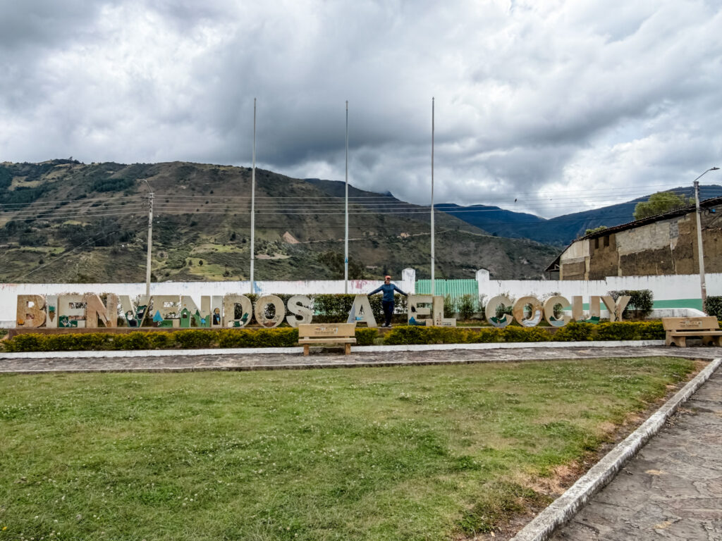
Before you lace up your boots, it helps to know a little about the history of El Cocuy. This isn’t just a trailhead town. It’s shaped by centuries of indigenous life and colonial history. It also sits inside one of the rarest ecosystems on the planet, all packed into a small corner of Boyacá.
Here’s the context that makes the permits, the guide requirement, and the landscape itself make a lot more sense.
Where the Name Comes From
Long before Spanish colonizers arrived, this area was home to the Laches. They were an indigenous group led by a chief known as Cocui. Their name for the settlement is where “El Cocuy” comes from, originally recorded as Chocué or Cochuy. The Laches held a striking belief: when a person died, they became a stone, later taking on human form again. Stones, in other words, weren’t just landscape. They were ancestors.
Spanish forces founded the town in 1541, making it one of the earliest colonial settlements in the region! Fun fact: El Cocuy was the fourth town officially founded by the Spanish in what’s now Colombia. It came after Bogotá, Vélez, and Tunja. It didn’t officially become a municipality until 1751. You can see it in the colonial-era buildings, church, and central plaza that still reflect that long history today.
The U'Wa and Their Connection to the Sierra
While the Laches and other early groups have largely disappeared, the U’Wa remain. They’re the region’s native community and the spiritual protectors of the Sierra Nevada del Cocuy. Their relationship with the mountain isn’t symbolic. It’s foundational to how the park itself is managed.
The U’Wa consider the high peaks sacred ground. Their traditional belief holds that snow shouldn’t be touched or walked on. That belief is a major reason certain sections of the park stay closed to visitors. It’s also why daily hiking capacity is limited across the trails that are open. When guides talk about permits, quotas, or restricted routes, this is the reason behind it, not just red tape.
It’s a piece of history worth carrying with you on the trail. You’re not just hiking through scenery. You’re moving through land that’s held deep meaning for a people who are still here.
You’ll find something similar in Parque Tayrona, where indigenous groups like the Kogi and Arhuaco are recognized as caretakers of the Sierra Nevada de Santa Marta. Coming from the U.S., the history with Native communities is nothing to point to with pride. So it stands out to see a working relationship like this between local authorities and indigenous communities. It’s not simple, and it’s probably not perfect. But it’s real and collaborative, and that’s worth recognizing.
The Park's More Recent History
The park itself is younger than you might think. The land was first protected in 1959 as a forest reserve, but it wasn’t officially established as a national park until 1977. For decades after that, the region was largely cut off from the rest of the country. Guerrilla groups used the area as a strategic corridor between departments. Tourism to the park stayed minimal simply because it wasn’t safe.
More recently, the park closed again, this time from February 2016 to April 2017. The U’Wa community had raised concerns that the glacier was deteriorating faster than it should. The tipping point was a video of tourists playing soccer on the snow, which the U’Wa saw as a direct violation of sacred ground. When the park reopened, it came with new rules that are still in place today. Visitors can’t walk or slide on the snow, camping overnight inside the protected area isn’t allowed, and every visitor has to sit through a mandatory induction talk before hitting the trail.
It’s a reminder that this park isn’t just a scenic backdrop. It’s a living, carefully negotiated space, and the rules you’ll follow as a visitor exist because of that history, not in spite of it.
On the Age Minimum
Officially, the park doesn’t allow kids under 10, citing the physical demands of the hike and the altitude. That’s the rule you’ll find in writing. But it’s worth hearing what Marta told us on the ground: a pueblo kid who’s grown up at altitude and a city kid turning 10 are not the same hiker. Kids from Cocuy are used to the elevation, the terrain, and the pace of life at 2,700 meters. A kid coming from sea level or a lower-altitude city is starting from zero on all three.
If you’re planning to bring your own kids, especially ones who don’t get much altitude or trail time at home, it’s worth treating 10 as a legal floor rather than a real readiness marker. Waiting until closer to 13+ is a more honest bar for a trek at this elevation, once they’ve had more experience with regular hiking.
What Makes the Páramo So Rare
The high-altitude ecosystem surrounding El Cocuy is called páramo. It’s one of the reasons this park stands out from other hikes you may have done before.
Páramo only exists in a handful of places worldwide, mostly in the northern Andes, and it looks like nowhere else. Tons of frailejones, tall, fuzzy-leafed plants that can live for decades, stretch across the landscape. Glacier-fed lagoons and windswept ridgelines fill in the rest of the view. The ecosystem plays a bigger role than it looks like it should. Páramo soil and vegetation capture and slowly release water, feeding rivers that entire regions depend on downstream. Walking through it feels closer to another planet than a typical mountain trail.
One detail that’s easy to miss: not all frailejones grow at the same pace. Depending on the species, they can add anywhere from about 1 cm to 5 cm in height per year. That’s part of why some plants you’ll pass are barely bushes while others tower well above head height. At that rate, the tallest ones you see on the trail could easily be a century or more old. It’s a slow-motion kind of scale, hard to wrap your head around while you’re standing right next to it.
If you have kids along, it’s worth introducing them to Frailejón Ernesto Pérez before the trip. It’s a catchy Colombian kids’ song built around a cartoon frailejón. The lyrics are really a recycling and water-conservation lesson in disguise. It went viral across Colombia a few years back, and it’s a fun way to get kids thinking about the ecosystem before they’re standing in the middle of it. It was stuck in my head multiple times a day during our trip.
Wildlife You Might Spot
The páramo isn’t just plants. Keep an eye out on the trail, and there’s a real chance you’ll run into some of the park’s more memorable residents.
The Ones You’re Most Likely to See
The Andean condor is the headliner. It’s one of the largest flying birds in the world. Spotting one gliding over the ridgelines is the kind of moment that’s hard to describe until it happens to you. I saw one and it immediately became a core memory.
You might also come across a cusumbo, the local name for the mountain coati. At first glance, it can look a bit like a small anteater with its long pointed snout, but it’s actually a relative of the raccoon. They tend to move in small groups and are more curious than shy, so don’t be surprised if one gets close.
Keep an eye on the rocks, too. The park is home to its own species of lizard, found only in this part of the Andes. You’ll likely spot a few sunning themselves along the trail on a clear day.
Rarer Sightings Worth Knowing About
There’s more out there than what you’ll typically see on a single trip, but it’s worth knowing what shares this landscape with you:
- Oso andino (Andean or spectacled bear): South America’s only bear species, and a genuinely rare sighting. Someone on another trail actually spotted one. I’m still heartbroken it wasn’t me.
- Puma: present in the park, though sightings are uncommon since they tend to avoid people.
- Danta (mountain tapir): a large, shy herbivore that plays a big role in spreading seeds through the park’s forests.
- Venado (deer): both white-tailed deer and the smaller soche deer move through the lower, forested sections of the park.
- Águila real and gallito de roca: two striking birds worth watching for alongside the condor, especially in the early morning or late afternoon.
Most of these are more shy than the cusumbo, so don’t expect a guarantee. But between the birds overhead and the tracks underfoot, it’s worth paying attention even when the trail itself is the main event.
Nearby Places Worth Exploring
If you’re building extra days around your trek, a few nearby spots are worth adding to the trip.
- Termales de San Luis (Güicán): A short distance from Güicán, these natural hot springs sit at high altitude and are fed by mineral-rich mountain water. After days of hiking, this felt legit amazing. 10/10 would recommend. There are a few different pools to choose from in the area, so it’s worth asking locally which one fits what you’re looking for.
- Güicán: The second gateway town to the park, about 43 km from El Cocuy. Beyond being a hiking base, it has its own colonial character, local trails, and a slower pace worth a stop even if you’re not starting your trek from here.
- Guacamayas: A small, colorful pueblo known for handwoven crafts made from fique and straw. It’s considered one of the most beautiful pueblos in Boyacá. It’s also a quieter, artisan-focused stop if you want a break from trail planning, and a good place to pick up a handmade souvenir that actually supports the town you’re buying it from.
Where I Learned This
A lot of what we know here came from Alfredo, Marta’s husband, from Marta herself, and from Luciana, our other guide, on car rides to and from the hikes. Speaking Spanish on a trip like this isn’t just about getting around. It’s about respect. It’s also about getting to hear these stories directly from someone who grew up in them, instead of reading a summary somewhere else. Some of the best moments of the trip happened in those conversations, not on the trail. A bit of googling filled in the rest.
Why This Context Matters
None of this history changes the packing list or the bus schedule, but it changes how the trip feels. Knowing where the name El Cocuy came from, why the U’Wa’s relationship with the mountain shapes the rules you’ll follow, and what makes the páramo so ecologically rare turns a hike into something closer to a real visit.
For a lot of us who already love being outside, that’s the natural next step. It’s not just about the summit or the photo at the top. It’s about understanding where you actually are, who’s been there before you, and what the land itself has been through to still look like this. The trail doesn’t change. What you carry with you on it does.
Next up: what to actually pack for the trek, once you’re ready to put all of this into your boots.
More El Cocuy Guides
- El Cocuy Packing List: What to Bring for the Trek: Everything that made it into our bags for two big hikes and one acclimatization day.
- How to Get to El Cocuy, Colombia: The Full Route Guide: The route from Bogotá, bus options, driving tips, and where to stop along the way.
- Where to Stay in El Cocuy: Hostal El Caminante: Why this hostal, run by Marta, made both of our trips easy.
- The El Cocuy Trek: Laguna Grande de la Sierra and Púlpito del Diablo: What the actual hikes are like, what they cost, and what to know if you’re bringing kids.

MEET SARAH
Welcome! I’m Sarah. I started this blog to be a resource for others around a few of my favorite things: living in Colombia, DIY projects, places traveled, and day-to-day life. My hope is that it can a place of inspiration and encouragement to help you plan the next project or adventure of your own!