This post may contain affiliate links. Read my full disclosure here.
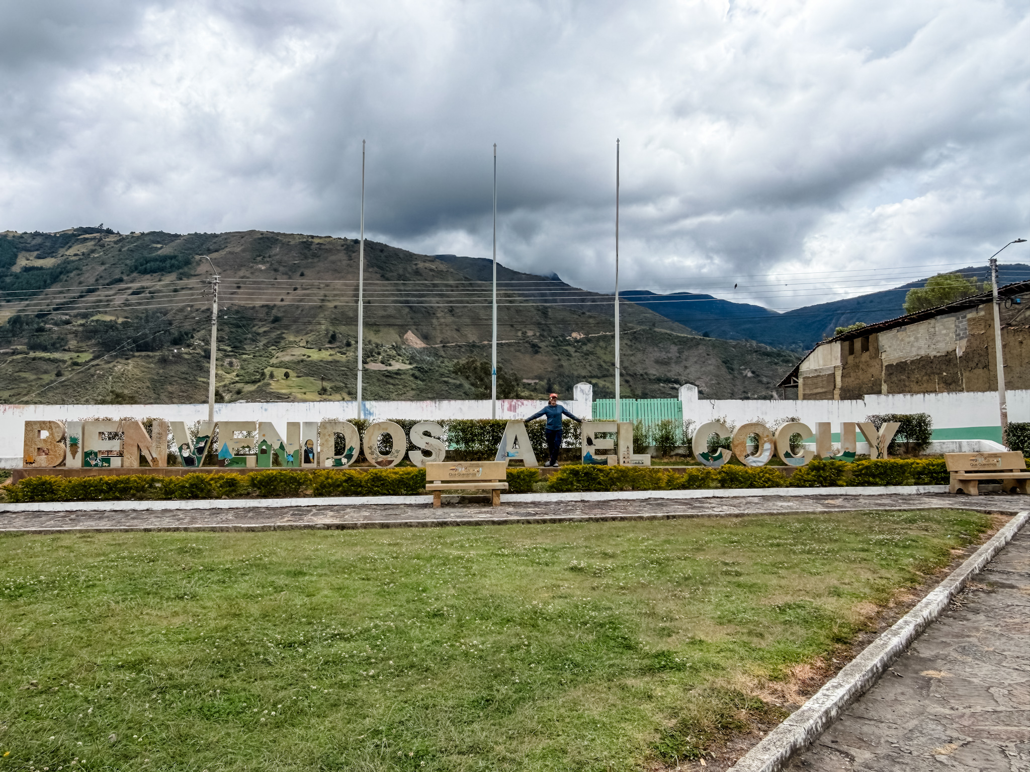
Before you lace up your boots, it helps to know a little about the history of El Cocuy. This isn’t just a trailhead town. It’s shaped by centuries of Indigenous life and colonial history. It’s also the gateway to the Sierra Nevada del Cocuy, along with Güicán and Chita, where high-mountain páramo is part of a much bigger landscape of glaciers, forests and foothills. The national park stretches across Boyacá, Arauca and Casanare.
This is the background that makes the permits, the guide requirement and the landscape itself make a lot more sense.
Where the Name Comes From
Long before the Spanish showed up, this area was home to Indigenous communities that colonial records call the Laches. Boyacá’s government lists older versions of the town’s name as Cochuy and Chocué. Where “El Cocuy” actually comes from depends on who you ask. The Museo Comunitario Santos Gutiérrez shares one version and says up front that it’s oral tradition. There’s more history here than one tidy name story can hold.
The Spanish colonial settlement dates to 1541, and Boyacá’s tourism authority says El Cocuy became a municipality in 1751. The historic center mixes colonial and later architecture. That same authority dates the current parish church to 1914, so not everything around the plaza is colonial. You can still feel the long history in the streets and buildings.
The U’Wa and Their Connection to the Sierra
The U’wa are a living Indigenous people with ancestral ties to the Sierra and a much wider territory. They call the snow-covered peaks Zizuma, and the mountains hold deep spiritual meaning for them. Their fight to defend that land has shaped the debates over tourism and park management. This isn’t a culture that belongs only to the past.
What the U’wa have said
U’wa authorities have spoken against walking on the sacred snow and about what tourism does to their culture and the environment. Their 2016 statement, published by ONIC, is worth reading in their own words.
Why the rules are there
- The U’wa’s concerns: That history is part of what’s behind the restricted routes your guide will explain.
- Conservation and visitor management: Authorized hikes stop at the glacier’s edge, and trail quotas account for environmental, social and cultural limits.
So it’s more than red tape, and there’s more than one reason behind it.
It’s a piece of history worth carrying with you on the trail. You’re not just hiking through scenery. You’re moving through land that’s held deep meaning for a people who are still here.
There’s a useful comparison at Tayrona, where Parques Nacionales describes periodic closures tied to conservation and the cultural work of the Kogui, Wiwa, Arhuaco and Kankuamo peoples. Coming from the U.S., the history with Native communities is nothing to point to with pride, so seeing Indigenous voices at the center of the conversation stands out to me.
But dialogue is only part of the story. In its 2024 judgment on the U’wa people’s rights, the Inter-American Court of Human Rights found that Colombia had failed to ensure their continuing participation in El Cocuy’s administration. It ordered their involvement in management and conservation where the park overlaps their resguardo, or legally recognized Indigenous territory. That’s an important part of this history too. It doesn’t mean the relationship is resolved.
The Park’s More Recent History
The park is younger than you might think. It became a national park in 1977. Colombia’s 1959 forest law had already set the area aside as the Cocuy forest reserve, but that was a different kind of protection, not the same park under another name. Armed conflict has also touched the wider region and the people who live there. So the story isn’t that the place was cut off for decades and then suddenly opened up to hikers. It’s messier than that.
What happened
- 2016: Tourism was interrupted amid U’wa and campesino protests over cultural and environmental impacts. A video of people playing soccer on the snow got a lot of attention, but the dispute went much deeper than one incident.
- July 2016: Formal restrictions followed.
- April 6, 2017: A partial reopening allowed day visits on three routes to the glacier’s edge. No overnight camping and no walking on the snow. Registration and an induction talk were part of the setup.
For a trip today
Use the current park instructions, not an old itinerary. The glacier-edge limit, day-visit rules, registration and induction are still part of the visitor framework, but openings and practical details can change.
It’s a reminder that this park is a living place shaped by conservation, negotiation and fights over rights. The rules you follow as a visitor have that history behind them.
On the Age Minimum
- The rule: The park doesn’t allow children under 10. That applies no matter where a child grew up.
- What Marta told us: A pueblo kid who’s grown up at altitude and a city kid turning 10 are not the same hiker. That stuck with me. El Cocuy town sits at about 2,750 meters, and experience on mountain trails varies enormously. I took her point as a reminder to look beyond birthdays, not as an exception to the entry rule.
If you’re bringing your own kids, especially ones who don’t get much altitude or trail time at home:
- My take: Treat 10 as the minimum entry age, not a sign they’re ready. I’d wait until closer to 13 or older, after they’ve done more regular hiking. That’s my personal comfort level, not a medical cutoff.
- What the medical guidance says: Children can develop altitude illness just like adults, and being fit doesn’t prevent it. Plan gradual acclimatization and talk to your child’s clinician about their health and your itinerary.
- The practical stuff: My trek guide covers the requirements.
What Makes the Páramo So Rare
Higher up, above the gateway towns, you reach páramo, a tropical high-mountain ecosystem. It’s one of the reasons this park stands out from other hikes you may have done.
Páramo is found mainly in the northern Andes, with some examples farther north in Central America, and it looks like nowhere else. Tons of frailejones, those tall plants with fuzzy leaves, stretch across the landscape. Lakes and windswept ridgelines fill in the rest of the view. The ecosystem does a bigger job than it looks like it should. Its soils, wetlands and vegetation help store and regulate water for the rivers and communities downstream, and the Humboldt Institute explains that water connection. Walking through it feels closer to another planet than a typical mountain trail.
One detail that’s easy to miss is that frailejones grow slowly, and not all at the same pace. It depends on the species, the plant’s age and the conditions around it. A tall one has years of growth behind it, but height alone doesn’t tell you how old it is. It’s a slow-motion kind of scale, hard to wrap your head around when you’re standing right next to one.
If you have kids along, introduce them to Frailejón Ernesto Pérez before the trip. It’s a catchy Colombian kids’ song from Cuentitos Mágicos, an animated series from Señal Colombia and Piragna, and the message is about caring for water and the planet. The broadcaster shares the story behind the character. The song went viral in 2022, and it’s a fun way to get kids thinking about the ecosystem before they’re standing in the middle of it. It was stuck in my head multiple times a day on our trip.
Wildlife You Might Spot
The park isn’t just plants, and its wildlife lives across a much wider range of habitats than the high trails you’ll hike. These are some of the animals associated with the area. Keep your eyes open, but treat any sighting as a bonus.
A Few Wildlife Highlights
The Andean condor is the headliner. It’s one of the largest flying birds in the world. Spotting one gliding over the ridgelines is the kind of moment that’s hard to describe until it happens to you. I saw one and it immediately became a core memory.
The cusumbo de páramo, or mountain coati, is another animal documented in the region. That long pointed snout can make it look like a small anteater at first glance, but it’s a relative of the raccoon. Common names vary, so ask your guide what you’re looking at. If you see one, give it space instead of trying to get it closer.
Keep an eye on the rocks, too. Parques Nacionales lists a lizard called the lagarto collarejo, Stenocercus lache, which is native to Colombia’s northeastern Andes. Ask your guide what you’re looking at instead of assuming every lizard is the same one.
More of the Park’s Wildlife
There’s more out there than you’ll see on a single trip, but it’s good to know who shares this landscape with you:
- Oso andino (Andean or spectacled bear): South America’s only living bear species. Someone on another trail actually spotted one. I’m still heartbroken it wasn’t me.
- Puma: Listed among the park’s mammals, but don’t plan a hike around seeing one.
- Danta (tapir): Also on the Parques Nacionales list. Remember the protected area covers forests and foothills, not just the high trails.
- Venado (deer): The park’s wildlife lists include both white-tailed deer and soche deer.
- Birds beyond the condor: Older park inventories include águilas and gallito de roca. Those records cover all the park’s habitats, so don’t count on seeing them along your trekking route.
None of these sightings is guaranteed. Watch quietly, keep your distance and don’t feed the wildlife. Between the birds overhead and the tracks underfoot, it’s worth paying attention even when the trail itself is the main event.
Nearby Places Worth Exploring
If you’re building extra days around your trek, a few nearby spots are worth adding.
- Termales de San Luis (Güicán): Hot springs in the San Luis area near Güicán de la Sierra. After days of hiking, this felt legit amazing. 10/10 would recommend. Ask locally about the different bathing options, and confirm the facility’s hours, entry price and transport before you head out.
- Güicán de la Sierra: The other gateway town to the park, with its own plaza and local character. Worth some time outside the hikes too. Check your route and current travel time instead of trusting a single distance number.
- Guacamayas: A small, colorful pueblo known for cestería en rollo, coiled basketry made with straw and colored fique. If you want a break from trail planning, it’s a good artisan-focused stop, and buying straight from a local maker supports the work you’re taking home.
Where I Learned This
A lot of what we know here came from Alfredo, Marta’s husband, from Marta herself, and from Luciana, our other guide, on car rides to and from the hikes. Speaking Spanish on a trip like this isn’t just about getting around. It’s about respect. It’s also about hearing these stories directly from someone who grew up in them instead of reading a summary somewhere else. Some of the best moments of the trip happened in those conversations, not on the trail.
A bit of googling and the official and research sources linked throughout filled in the rest. Local stories, documented history, park rules and U’wa accounts each give you a different perspective, so I don’t treat them as interchangeable.
Why This Context Matters
This history won’t tell you which boots to pack or which bus to catch, but it changes how the trip feels. Knowing the stories attached to El Cocuy’s name, the U’wa’s ongoing relationship with the mountain and what makes the páramo so unusual turns a hike into something closer to a real visit.
For a lot of us who already love being outside, that’s the natural next step: understanding where you actually are, who’s been there before you, who’s still there and what the land has been through. Here, the authorized visitor trails stop at the glacier’s edge, so the summit isn’t the point of the trip. The trail doesn’t change. What you carry with you on it does.
Next up: what to actually pack for the trek, once you’re ready to put all of this into your boots.
More El Cocuy Guides
- El Cocuy Packing List: What to Bring for the Trek: Everything that made it into our bags for two big hikes and one acclimatization day.
- How to Get to El Cocuy, Colombia: The Full Route Guide: The route from Bogotá, bus options, driving tips, and where to stop along the way.
- Where to Stay in El Cocuy: Hostal El Caminante: Why this hostal, run by Marta, made both of our trips easy.
- The El Cocuy Trek: Laguna Grande de la Sierra and Púlpito del Diablo: What the actual hikes are like, what they cost, and what to know if you’re bringing kids.


Leave a Reply